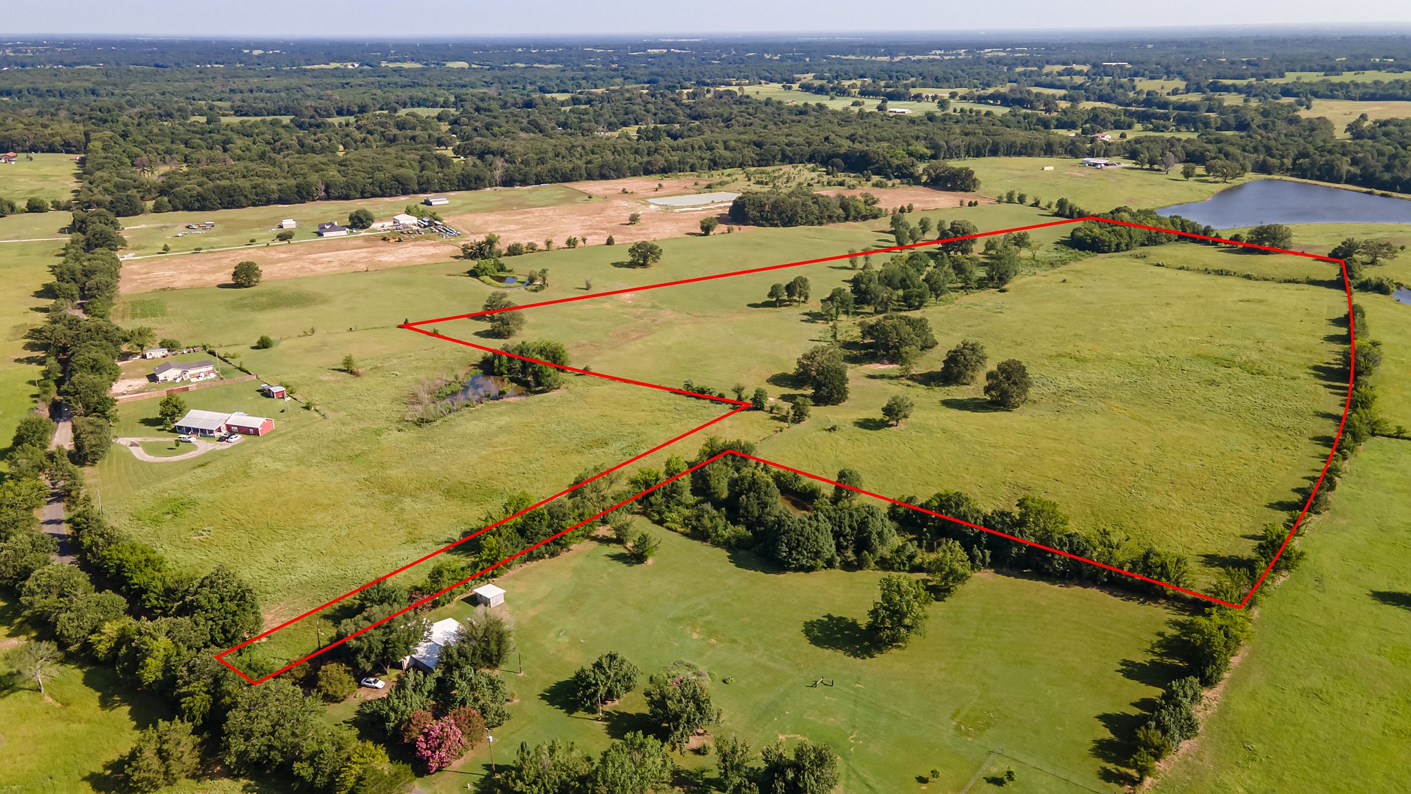
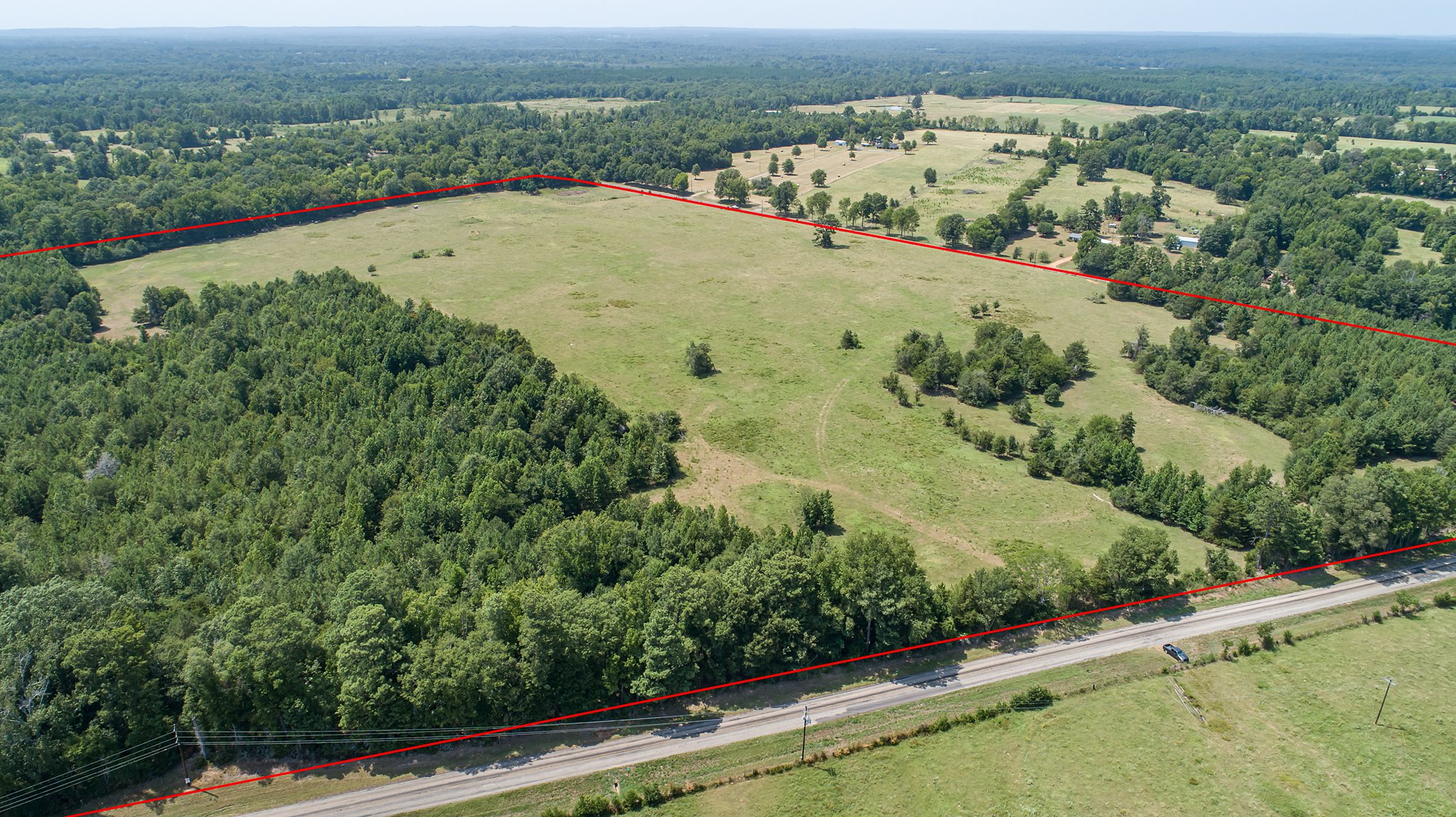
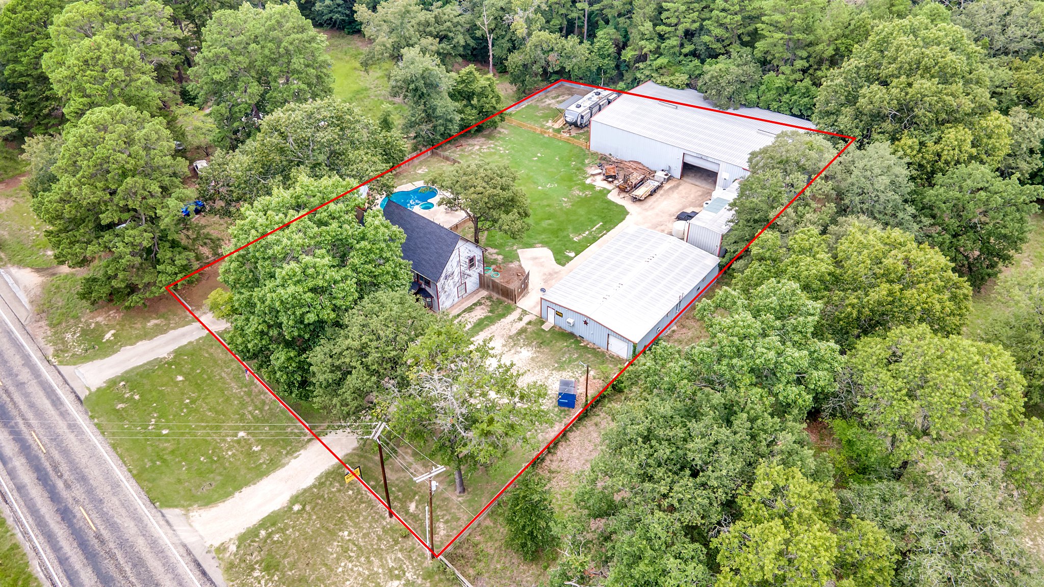
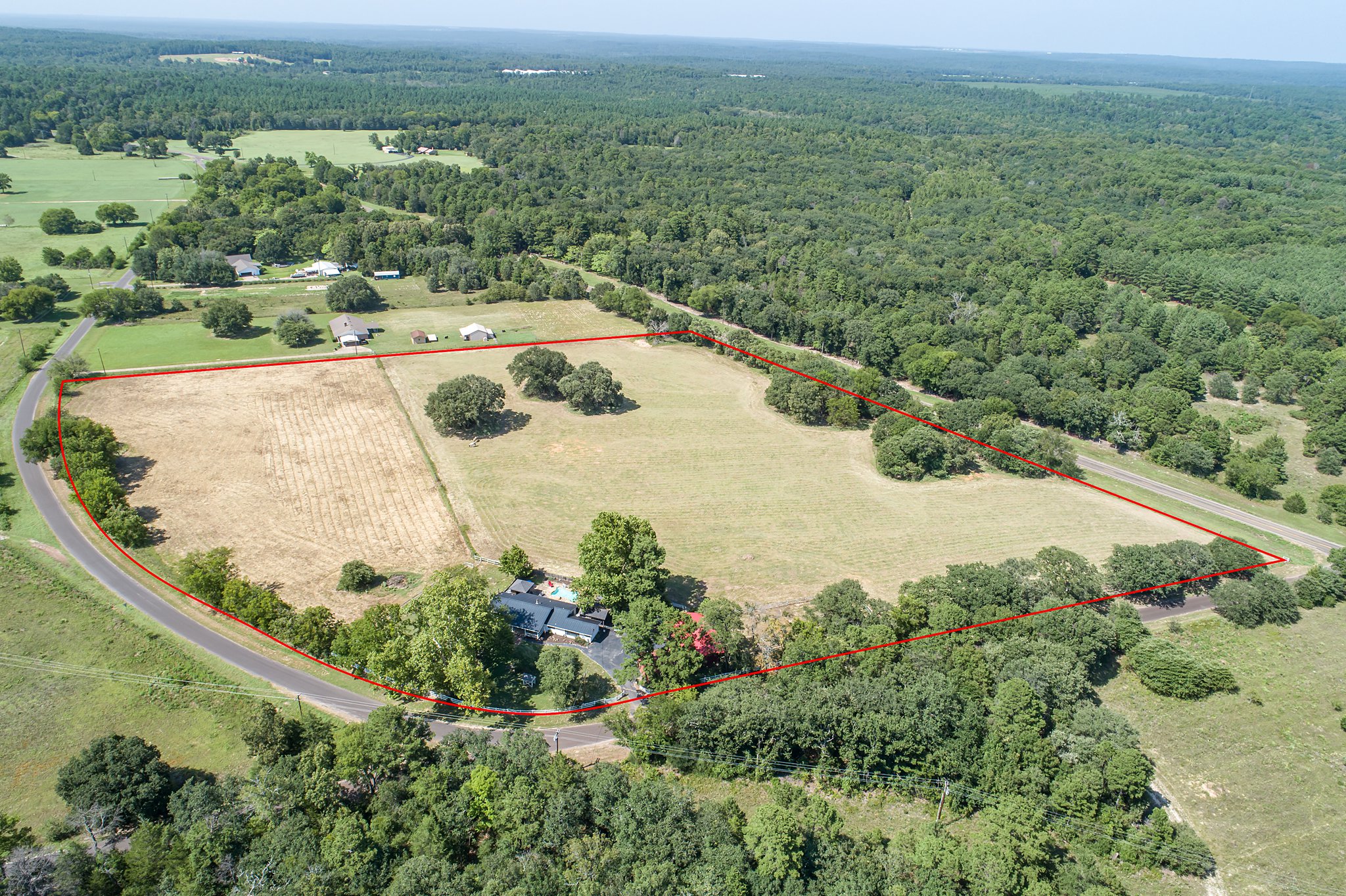
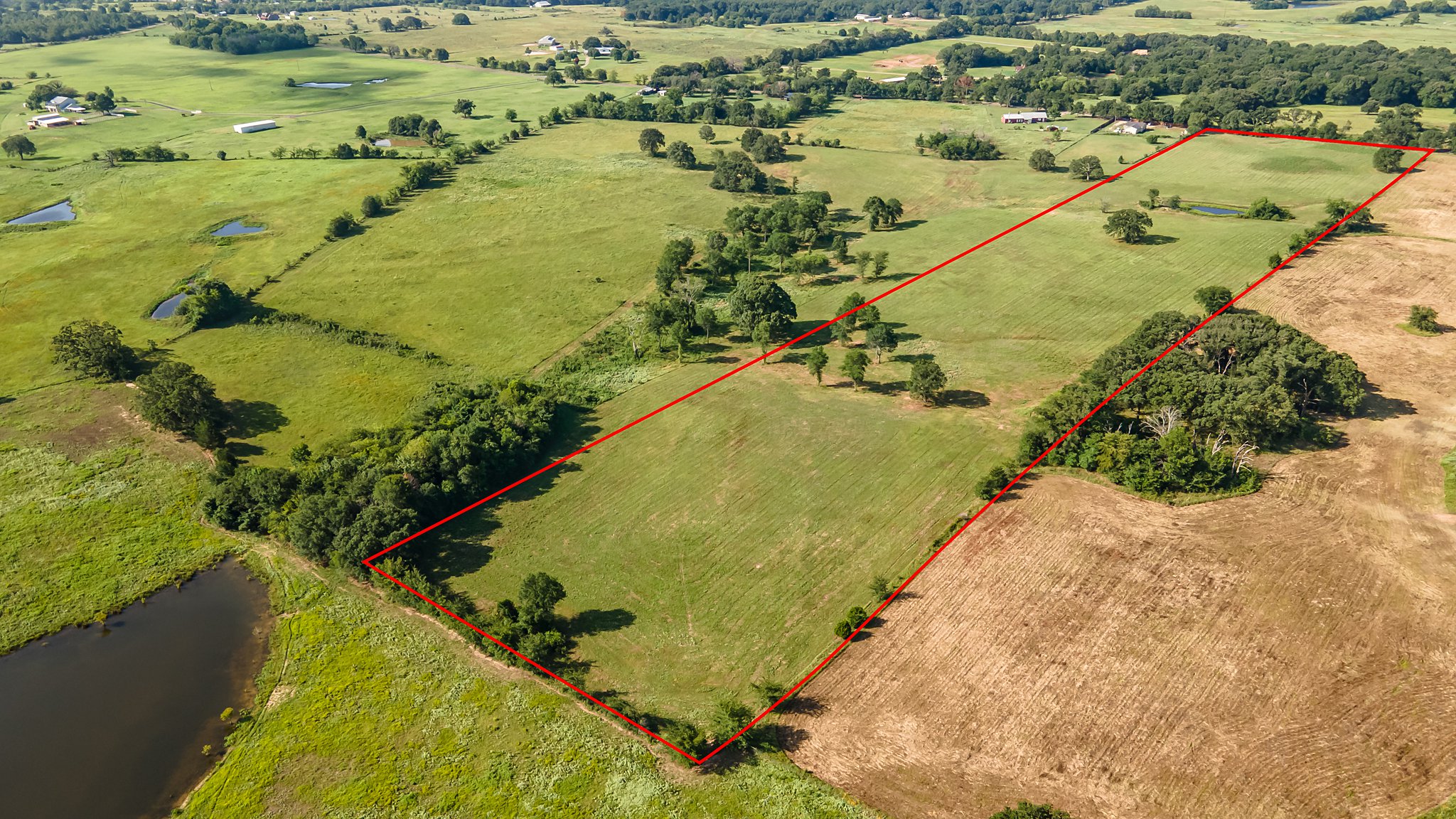
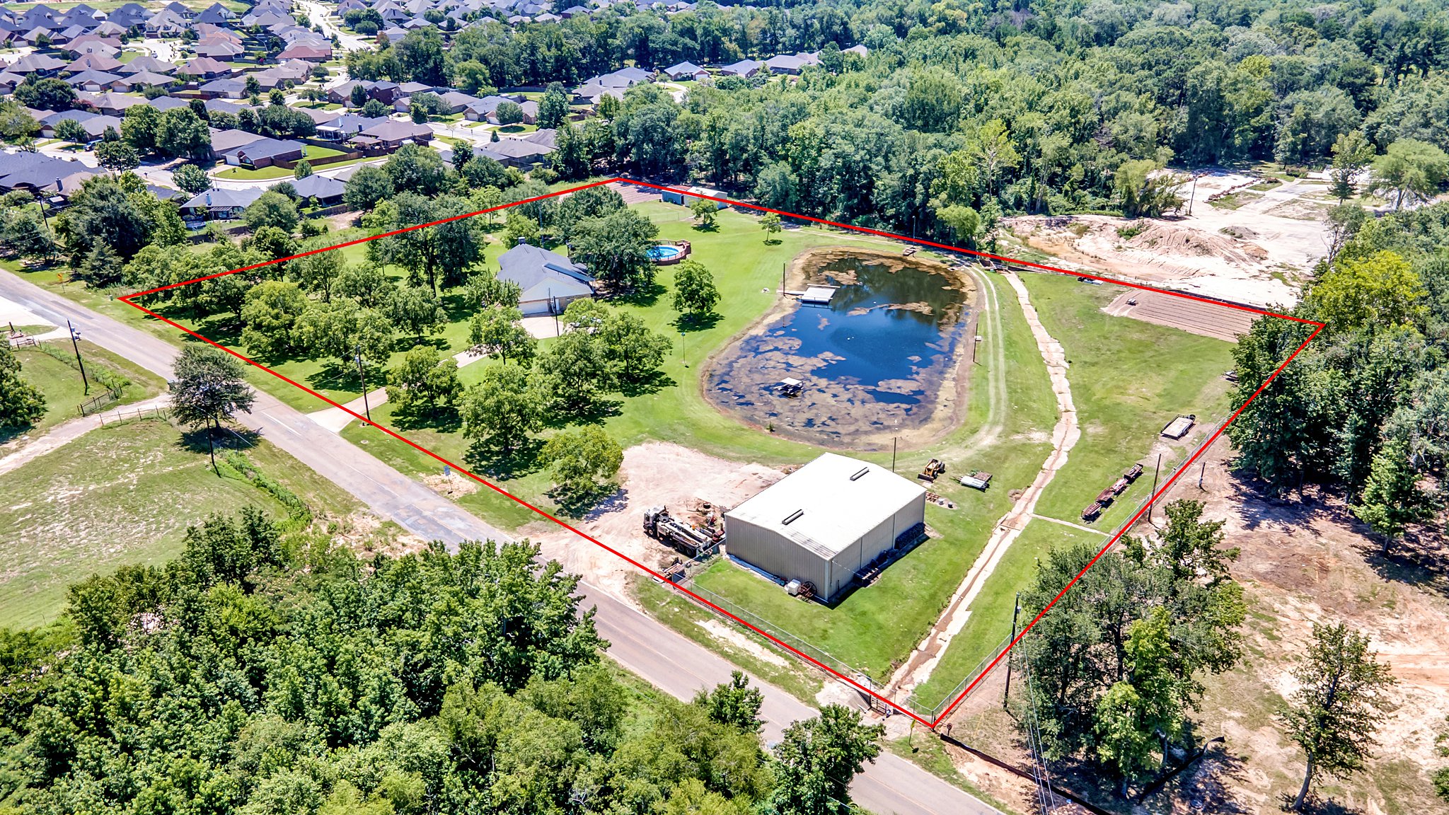
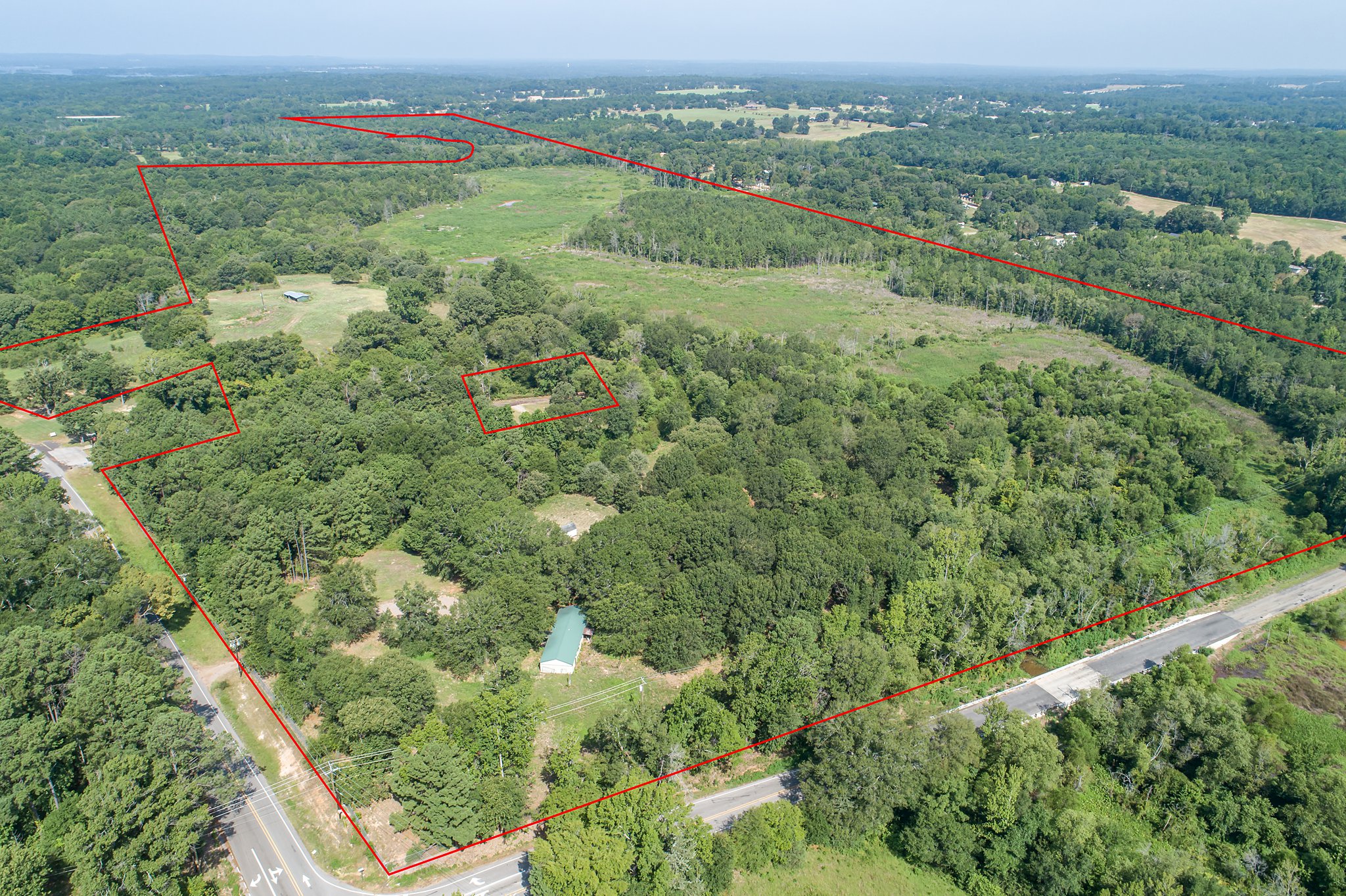
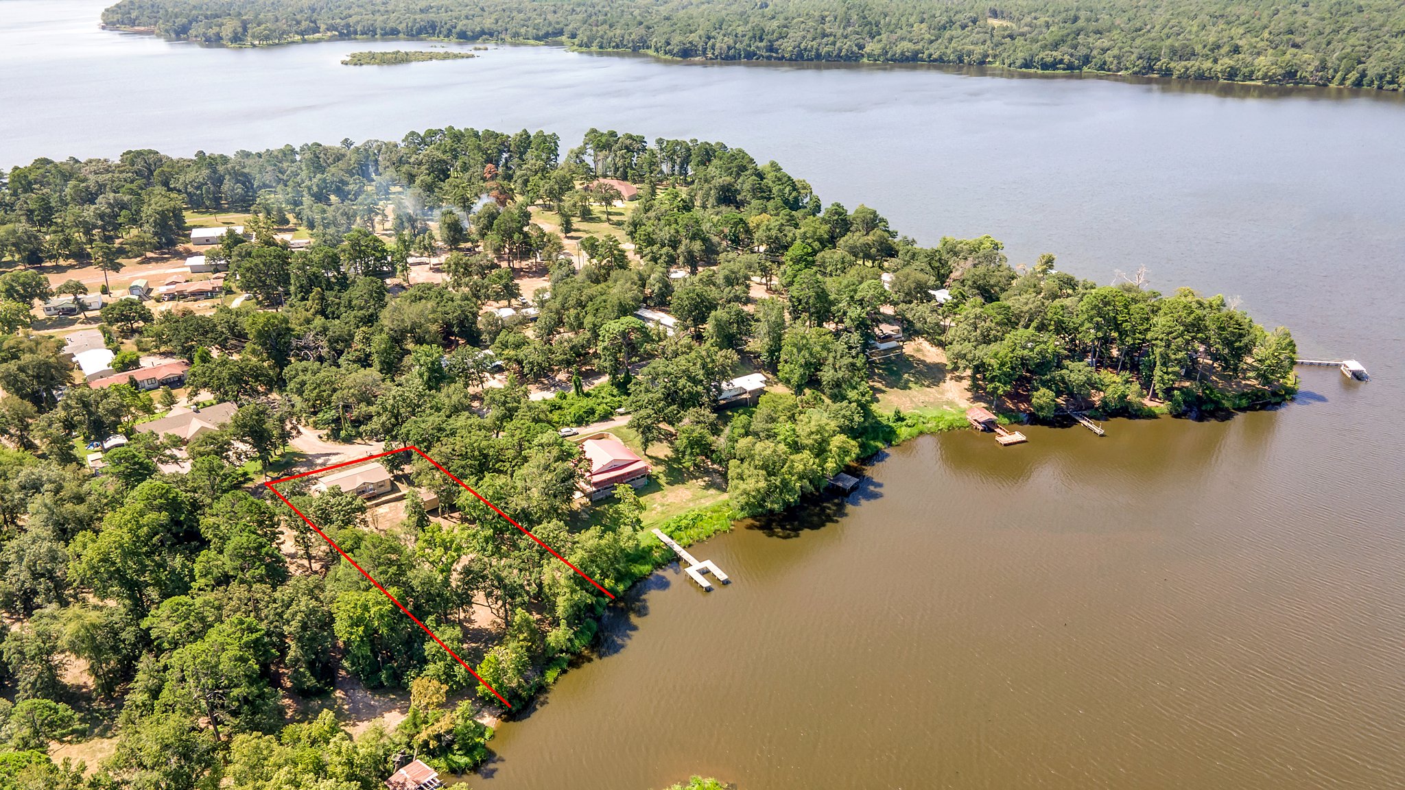
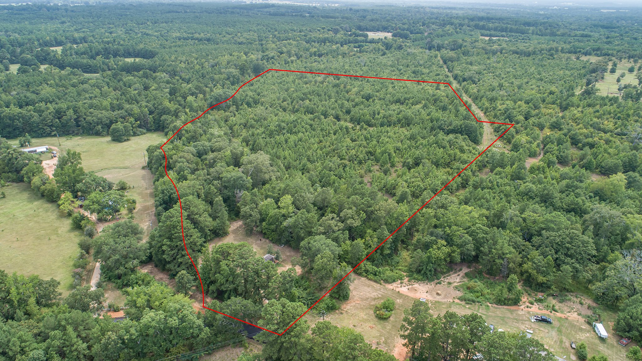
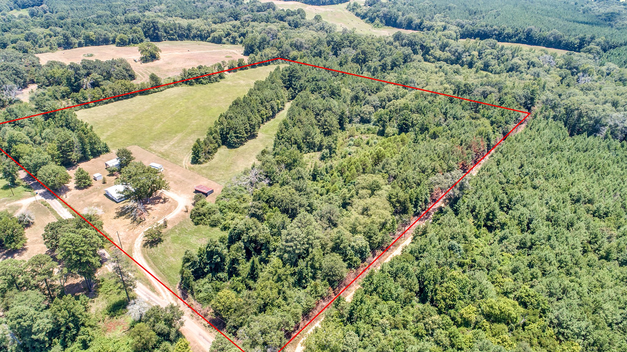
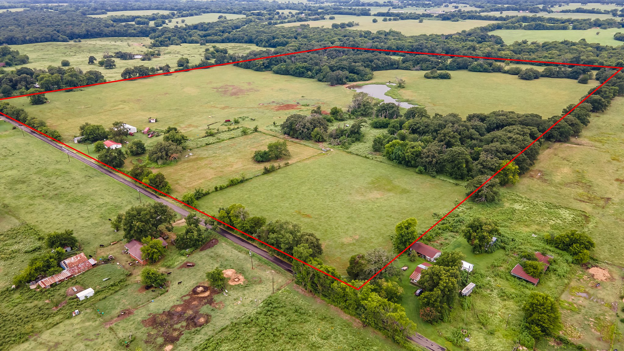
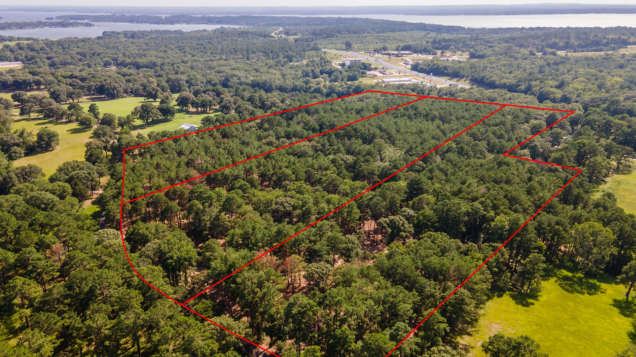
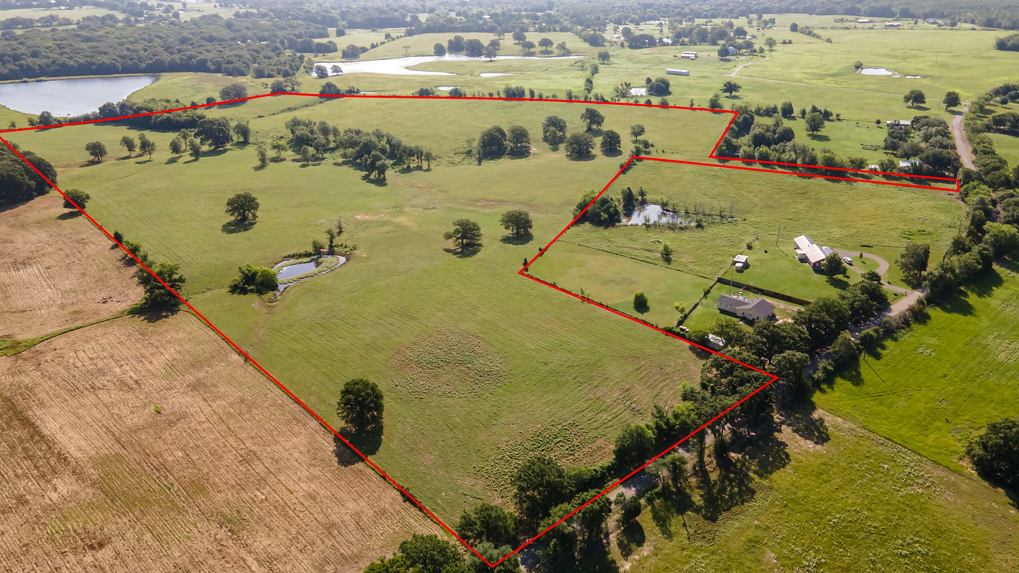
Aerial images are amazing at giving a fresh perspective and showing an entire property, but unfortunately they often show the neighbor’s property too.
Are you tired of aerial images that show more than just the property you’re trying to sell? We can help you create more informative and effective images by adding approximate property boundaries to our high-quality aerial shots. This will give potential buyers a better idea of what’s for sale and eliminate the guesswork of looking at wide aerial shots. Please note that while I do my best to ensure the accuracy of the boundaries I draw, it is ultimately the responsibility of the agent to provide accurate property maps and to double-check the drawn boundaries before using the images. The digital boundaries are intended to help buyers understand the scope of a property when looking at wide aerial images, but they are not intended to represent a survey.


